Interactive map of Waterford unveiled
The sculpture created by Street Art Inc.
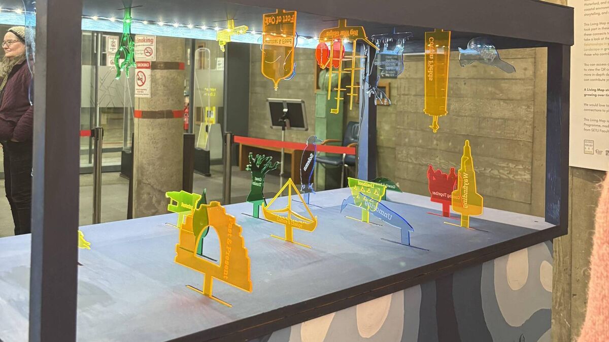
Attendees at the Index Gallery in Waterford Library were invited to consider how limited our view of things like ‘home’ and ‘maps’ may be. The theme of the evening was ‘Coastal Cartographies’ where ecologists, design students and artists all worked together to create a ‘living map’ of Waterford.
‘That word ‘home’ can convey that sense of place, that sense of connection but it can also be connected with upheaval and displacement; it all depends on your personal narrative.” Explained Joy Rooney, a lecturer and researcher in design in SETU.
“Maps fascinate me.” said Tasneem Khan, founder of the School of Ecology and Art. She believes they are a “way of expressing what we care about. If you care about borders and politics, you will make a map that really defines those. If you care about exclusion, you will make a map that puts you at the center. But if you care about stories, memory, ecology, you might make a map about what's missing.”
Read More
What was supposed to be a single event for science week turned into a five month long endeavour to map Waterford’s coastline.
Each group (consisting of TY students, charity organisations and local residents) was given a journal and responded to prompts as they walked around the area and listened to experts in history, geology and ecology.
They then compiled sound recordings, photographs and journal pages and handed it all over to artists from Street Art Inc.
The artists, Adela Passas and Cormac Dillon, then analyzed all of the material and from that, they created two ‘living maps.
The sculpture is a 3D map “that brings together the stories and observations of these community groups into one physical object.” The sculpture features outlines of boats, clouds and animals. Each outline has a particular story or significance to the coast of Waterford. The great auk, for example, is featured. A penguin-like bird which is now extinct. The last one in Ireland was seen off the coast of Waterford.
As well as the sculpture, Research Ireland, S.E.A. School, Street Art Inc. and SETU have teamed up to create a digital, interactive map of Waterford.
“We tried to document little snippets of everything we did on those walks. The sounds we recorded, the things we saw, people’s impressions and we plopped on each site. And now we’ve opened it up for anyone to add to.”
You can see the sculpture and exhibition in the Index Gallery in Waterford Library and you can view the interactive map by following this link.


