'The Street Where You Live' - a Waterford book of identity
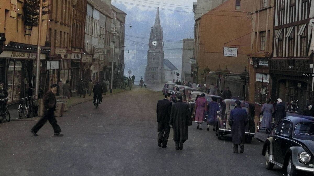
Barronstrand Street at the heart of Waterford city in days gone by, with a view of the Clock Tower.
My book, ‘The Street Where You Live’, contains almost 500 pages, and is about identity, memory, and the way in which history lives on in the everyday fabric of a city – it’s not just about placenames!
By uncovering what was lost and bringing it back into the light, we give Waterford a gift: a map not just of its streets, but of its soul.
Waterford is Ireland’s oldest city, and one of its most layered. Every street and lane, every road and suburb, carries echoes of the people who lived, fought, prayed, and traded here for more than a millennium.
To walk through the city is not only to move through space, but also through time: from the Gaelic communities who first named the fields and townlands, to the Vikings who shaped its quays, to the Normans who fortified and reorganised it, and to the later English and Irish generations who remade its landscape.
Placenames are the keys to that past. Some names have endured for centuries almost unchanged; others have been reshaped, anglicised, or erased altogether.
Yet when examined closely, they tell us as much about Waterford’s people as about its geography.
This article sets out to uncover those names, grouping them according to the cultural and historical layers that gave rise to them: Gaelic, Viking, Norman, and later influences. Together, they form a mosaic of memory, a map not only of streets but of the soul of a city.
Long before Waterford was a Viking stronghold or a Norman fortress, it was part of the Gaelic world. The Irish language shaped its earliest placenames, grounding them in the landscape and in religious devotion.
Fields, churches, and wells were central reference points, often named after saints or natural features. Gaelic names preserve the memory of religious foundations.
In the wider city area, we find Cill Mocorog, recalling an early Christian church dedicated to the otherwise obscure Saint Mocorog.
In the city we have St. Patrick’s and the long-lost St. Brigid’s, probably pre-Viking churches.
Meanwhile, older Irish names continued to survive in the hinterland: the following lost for over 400 years and recently discovered are; Béal Loch Buí (“mouth of the yellow lake”), once a rural place, now part of a tourist attraction; the townland Crann na Spíoróige (“tree of the sparrow”) now hosts a large pharmaceutical factory.
Faha Road, a “faha” or “faithche” referred to a “green” associated with a Gaelic house or settlement. The long-lost placename Liscarroy Road hints at a lios (fort or ringfort), showing that even within the city, memory of the Gaelic past persisted in the language of settlement and defence.
These names, rooted in the Irish tongue, survived centuries of conquest, often altered but not erased. They are linguistic fossils, telling us how the first Waterfordians saw their world.
The Viking period is represented by Ballygunner, derived from Baile Ghunair, “the townland of Gunnar”.
While Gunnar is Norse in origin, the form of the name is distinctly Gaelic: baile meaning homestead or settlement. Similarly, Ballytruckle (Baile Thorcail) recalls Thorkil, another Norse figure, but preserved in Irish form. These names embody the intermingling of Gaelic and Norse traditions, where Irish naming patterns framed the identities of Viking settlers.
Ballinakill, so familiar to Waterford people, comes from Baile na Cill, “the townland of the church”.
Nearby lies newly discovered Balymakill, which comes from Baile mhic Coiligh (not to be confused with Ballinakill), revealing another layer of Gaelic topography, one whose precise meaning uncovers new facets of the land. However, the name is not a corruption of the other and has a completely different meaning.
If Gaelic placenames root Waterford in Ireland, its Viking heritage connects it to the wider North Sea world. The Norse founded Waterford in 914AD, making it a linchpin of their trading empire, stretching from Dublin to York to Scandinavia itself. Although, as the discovery of a Viking settlement at Woodstown, near Mount Congreve, shows, the Vikings were in the Waterford area over 50 years before the foundation of the present city of Waterford. Their legacy survives not only in archaeology but in names still visible on the map of Waterford city.
Take High Street, one of the oldest thoroughfares in the city. Its original name was from the Norse: Búð, (Booth or shop), a clear sign of its role as a trading street. At various times it was known both as Booth Street and as High Street, an unmistakable echo of its Viking origins.
Nearby lies Colebeck Street, from the Old Norse kald bekk, meaning “cold stream”. Old maps confirm that the River Suir once flowed along what is now The Mall, entering the city as far as Colebeck Street. The name is both literal and evocative, capturing a detail of the medieval topography now long since altered.
Waterford’s very name – VeðrafjÇ«rðr, often translated as “fjord of the rams” or “windy fjord” – is a Norse inheritance. It places the city firmly within the Scandinavian imagination, reminding us that Waterford was not merely raided but settled, fortified, and deeply integrated into the Norse world.
In Irish, Waterford is known as Port Láirge, but not a stone’s throw from Port Láirge is Port Mór. Was this associated with Port Láirge or a pre-Viking Irish settlement? Probably the latter.
In 1170, Waterford fell to Strongbow and the Anglo-Normans, beginning a new chapter of urban transformation. The Normans fortified the city, established guilds, and reorganised its street plan. With this came a fresh wave of placenames, often tied to families, trades, or ecclesiastical institutions.
A quick question to tease your brains; “What charity, according to tradition, was founded by the early Normans and remains to the present day? At one stage it had 850 acres in Co. Waterford and 100 acres in Co. Kilkenny.” Answer at the bottom of the article.
The Normans left their imprint in churches, eventually gaining the reputation Parva Rom, meaning Little Rome. The following are some of the Norman churches. The site of the long-forgotten Saint George’s Church shaped the district around it.
Even more intriguingly, Waterford once had a church dedicated to Mary Magdalene – not a fiction from The Da Vinci Code, but a real medieval foundation, now forgotten except in records and recovered placename evidence.
St. John’s Priory, which stood off the Manor, and gave its name to John’s Street, John’s Lane, Prior’s Knock and Farronshoneen; St. Catherine’s Abbey, which stood on the site of the Court House in Catherine Street, gave its name to Catherine Street, Grange, Catherine’s Grange.
The Dominican Friary, whose ruins stand off Conduit Lane, gave its name to Blackfriars Street, and possibly Barronstrand Street.
The Normans also brought systems of land division that reinforced older Gaelic names. Their overlays sometimes replaced, sometimes preserved Irish forms, resulting in the hybrid naming patterns we still see.
Beyond the Gaelic, Viking, and Norman eras, Waterford continued to evolve. English colonisation brought widespread anglicisation of Irish names, as well as the imposition of new ones, tied to royal or imperial authority.
In the mid to late 1600s Irish guerrilla fighters called Rapparees appeared in Ireland. A street in the Ballybricken area, called Rapparrees Road, was named after them. Do you know where it was?
In the 19th century, the Famine left its mark in the landscape itself. Browne’s Road is remembered as a “Famine Road”, constructed in 1846 during relief works. Its very existence is a silent memorial to hardship, hunger and resilience.
Other names speak to political ambition and cultural identity. Davitt Street and Redmond Place were proposed as street names but never fully realised, yet their stories remind us of Waterford’s role in nationalist politics and the influence of figures like John Redmond.
The city’s humour and vernacular also played a role. Nicknames such as “Mattie’s Hill” preserve community memory of individuals otherwise lost to history. Informal terms like “Ratepayers’ Row” show how ordinary citizens engaged with civic life through language. Another city centre street was, for a short period, called Coronation Street.
The Applemarket, today a vibrant cultural space, had an earlier name; can you guess what it was? Markets were central to civic life, and street names reflected the wares sold there.
In 1963, there was a determined effort to get rid of all streets bearing the label “Lane”. With this move, we lost Buttermilk, Sheep’s, Goat’s, Gas House, lanes and many more. Can you guess the reason behind the change? Our younger readers with their 21st century sensibilities may be shocked at the reason.
The War of Independence is remembered all over the city in its street names. An example is the Cork Road houses where all of the streets are named after those involved in the struggle for Irish freedom.
A street is never just a route. It is an echo of past history, a line drawn through centuries of human activity. Buildings rise and fall, churches are built and forgotten, rivers are diverted, but the path of a street often endures. To walk Waterford’s streets is to step into the footprints of merchants, monks, raiders, soldiers, labourers, and emigrants.
Waterford’s placenames are not simply curiosities for historians; they are the DNA of the city’s identity. Gaelic saints, Viking chieftains, Norman guildsmen, famine labourers, nationalist leaders – all left their marks not only in records but in the very names of the streets we walk every day.
This book is an act of recovery. It draws from archives, maps, folklore, and oral tradition to give those names back to the people of Waterford.
It is also a celebration: of resilience, of continuity, and of the human need to remember.
For genealogists, historians, and local enthusiasts, the book offers a resource of lasting value. When we say the name of a street – whether it is High Street, Colebeck Street, Ballygunner, or Browne’s Road – we are invoking centuries of history.
We are, knowingly or not, keeping alive the stories of those who came before us.
In this way, ‘The Street Where You Live’ offers not just a guide to Waterford’s geography, but a deeper map: a map of memory, identity, and belonging.


